
How tall is Pilot Mountain?
(Even in these modern times with all the earth and space based technology who knows?)
1823
W.L. Spoon wrote in his “Gem of North Carolina” that the mountain was around 2,500 feet in 1929.

1929

The Greensboro Daily News in March of 1970 that the mountain stands 2,441 feet above sea level.


From: Answers <answers@usgs.gov>
Date: Wed, Apr 30, 2025 at 2:03 PM
Subject: U.S. Geological Survey Response [Ticket#511039] Pilot Mountain in Surry County, North Carolina height?
To: jackmac2013 <jackmac2013@gmail.com>
Hello,
The USGS uses Lidar data to produce the topographic maps now-a-days.
Pilot Mountain (Surry County) is on the USGS Pinnacle, NC 1:24,000 scale topographic map. There is no benchmark set on the peak so I cannot give you an exact figure. The newest map from 2022 uses elevation data from 2008, and has a contour interval of 20 feet. It has the height between 2360 ft and 2379 ft above sea level based on North American Datum 1983 (NAD83).
Older maps will have different elevations. That is a product of the methods used to determine elevations and make the maps at that time. Maps in the future may have a different elevation again as the data used to make them becomes more precise.
Good day
U.S. Geological Survey
Science Information Services
USGS Frequently Asked Questions
1-888-392-8545
Find us on Instagram, Facebook, X, and YouTube
Hello again,
I can see where the elevation of 2,421 comes from. It is from an older 1:24,000 scale USGS topographic maps originally from 1964. It shows some horizontal control with a spot elevation at the peak. Spot elevations are not a surveyed point; many spot elevations were dropped by the machine used by cartographers at the time to help make the map. However, my information on elevation was from the newest 1:24,000 scale USGS topographic map from 2022 which is produced using Lidar data, and is based on the North American Vertical Datum of 1988 (NAVD88), and horizontal datum NAD83.
I cannot comment all the other references you've supplied. I am not familiar with how those elevations were obtained/calculated.
Have fun
U.S. Geological Survey
Science Information Services
USGS Frequently Asked Questions
1-888-392-8545
Find us on Instagram, Facebook, X, and YouTube

Knowing the elevation would have been important to pinpoint the exact location of the start of the fire that happened on November 27, 2021 at Pilot Mountain State Park.

According to USGS using a 2022 topo map...
Pilot Mountain is 2360 feet to 2379 feet above sea level as of 2022.
Grassy Creek at the base of the mountain (near the Gillam Hotel) is 960 to 980 ft. above sea level.
The town of Pilot Mountain varies by location and is 1,060 to 1,260 feet above sea level.
So Pilot Mountain is around 1,400-1,419 or so feet above the Yadkin Valley. If you include the antenna of the Empire State Building they are roughly the same size. Roughly stated, Pilot Mountain is x3 the size of the Great Pyramid at Giza.
Pilot Mountain in 1823 was measured at 1,551 feet above Grassy Creek by UNC-CH geology professor. I have said it is around 1,500 feet in the past because of his estimate, but I think I'll go with the USGS and say around 1,400 now.
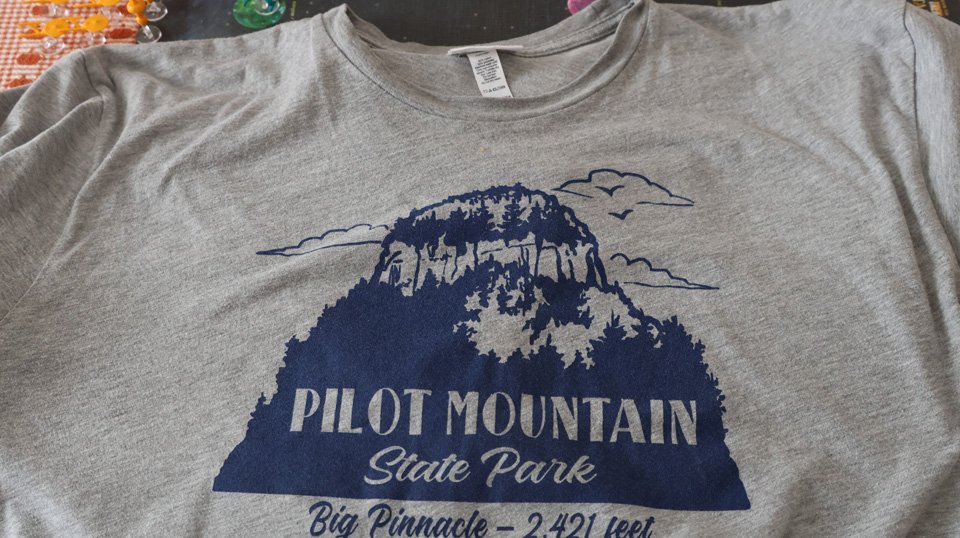
NOTE: Shirts sold at the Pilot Mountain State Park visitor center list the elevation as 2,421 feet.

This marker below is found on the Little Pinnacle overlook and there is another one like it on the Big Pinnacle near the flagpole holder at Pilot Mountain. In the general area of Pilot Mountain there are half a dozen or so more of these markers found close to the mountain.
